Answers
Click on a map pointer, use the answer numbers above, or click the directions at bottom of page to navigate...
When you really need to get it right,
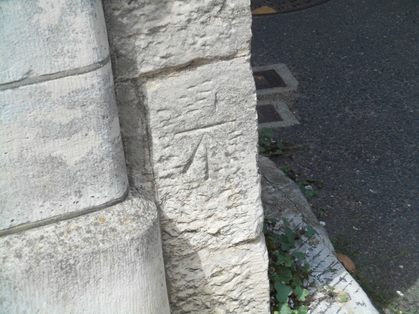
This mark will help you find the height
Which way is the arrow pointing?
upwards (Ordnance Survey cut benchmark on town hall)
Another benchmark (as in clue 1), but this time the mark is an Ordnance Survey benchmark. Originally part of surveys for military purposes, the OS surveys continued mapping the whole of the UK in great detail, and the OS maps are the definitive maps of the country. Benchmarks are accurately measured fixed points, with a documented height above sea level. Benchmarks were measured relative to "Fundamental benchmarks" : 190 precision marks across the UK. Those in turn are measured relative to the Ordnance Datum, which is located at the end of a pier in Newlyn, Cornwall. Local benchmarks are no longer in use (although the Fundamental benchmarks are), but hundreds of thousands of these marks remain on buildings, walls, bridges and rocks across the UK. The one here (one of about 60 in the town) was made during a survey in 1951, and is exactly 6.309 metres above mean sea level at Newlyn.
The mark itself is an upward pointing arrow (based on the government "broad arrow") but with an additional horizontal cut mark above it; this is the indentation where a surveyor's "bench" should be placed for precise accuracy.